cas_radar_example.pro
includes main-level programRADAR EXAMPLE
This script demonstrates reading a Cassini RADAR SAR image and projecting it onto an orthographical map for display.
The data file used, BIFQI22N068_D045_T003S01_V02.IMG, is too large (202 MB)
to include with the OMINAS distribution. This script will look for the file
under ~/ominas_data/sar/, and if not found, will download it from
PDS<http://pds-imaging.jpl.nasa.gov/data/cassini/cassini_orbiter/CORADR_0045/DATA/BIDR/BIFQI22N068_D045_T003S01_V02.ZIP>,
then unzip it.
Setup: The instrument detectors, translators and transforms must contain the
RADAR definitions, as is included in demo/data/instrument_detectors.tab,
demo/data/translators.tab, and demo/data/transforms.tab. Since the RADAR
data is in PDS format, the PDS detector and io functions must also be set up
in the corresponding tables, as is in config/tab/filetype_detectors.tab
and config/tab/io.tab.
There is no need for SPICE/Icy for this example. It can be run by doing:
.run cas_radar_example
Read SAR file
Cassini RADAR SAR image to read must be set in the variable img, otherwise this default location is used:
 ;Download the file, if needed
 ldir='~/ominas_data/sar'
 spawn,'eval echo '+ldir,res
 ldir=res
 img=ldir+path_sep()+'BIFQI22N068_D045_T003S01_V02.IMG'
 if ~file_test(img,/read) then begin
   print,'SAR file needed for the demo not found. Downloading it from PDS...'
   p=pp_wget('http://pds-imaging.jpl.nasa.gov/data/cassini/cassini_orbiter/CORADR_0045/DATA/BIDR/BIFQI22N068_D045_T003S01_V02.ZIP',localdir=ldir)
   p.geturl
   print,'ZIP file downloaded, decompressing it...'
   file_unzip,ldir+path_sep()+'CORADR_0045/DATA/BIDR/BIFQI22N068_D045_T003S01_V02.ZIP',/verbose
 endif

 ;Read the file
 dd=dat_read(img)
Display SAR file
Saturate the data to make the image better looking, since this is just for display purposes:
 da=dat_data(dd)
 dat_set_data,dd,da<4.5d0
tvim,da<4.5,zoom=0.05,/order,/new
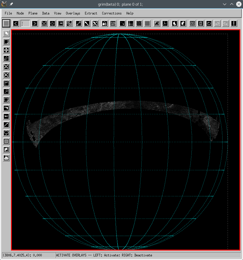
Map SAR file
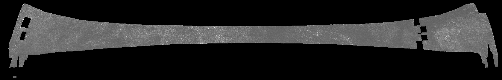
SAR data is provided in PDS as a map on the target, in an oblique rectangular projection, shown above. To use it, first we need to obtain the proper map descriptor from the data object:
mdr=pg_get_maps(dd)
 map_xsize = 4000
 map_ysize = 4000
 mdp= pg_get_maps(/over,  $
   name='TITAN',$
   projection='ORTHOGRAPHIC', $
   size=[map_xsize,map_ysize], $
   origin=[map_xsize,map_ysize]/2, $
   center=[0d0,-0.4d0*!dpi])
dd_map=pg_map(dd,md=mdp,cd=mdr,pc_xsize=800,pc_ysize=800)
 cd = pg_get_cameras(dd)
 pd = pg_get_planets(dd, od=cd)
 ltd = pg_get_stars(dd, od=cd, name='SUN')
 grim,dd_map,cd=mdp,od=cd,ltd=ltd,pd=pd[0],overlays=['planet_grid'],order=0
File attributes
| Modification date: | Mon Jan 7 14:49:54 2019 |
| Lines: | 32 |
| Docformat: | rst rst |